| The Elephant Run an offroad trail | |||||||||||||||
|
Last update: Apr 8, 2024
The Elephant Run.The Elephant Run is a 165 kilometer loop which winds through Khun Chae and Si Lanna national park, to the northeast of Chiang Mai. This route is not possible with a scooter since it includes a stretch of 2 hours driving on concrete and dirt trails. It's best to use a dirt bike like the Honda CRF300 Rally; which can be rented anywhere in Chiang Mai. Perhaps a larger enduro bike might work.
Starting from Chiang Mai take highway 118, which is a wide 4 lane highway: 2 by 2 lanes separated by a barrier. Once you are out of town there is much less traffic, and thus it is safer than the busy north-south highways (107 and 108). Drive north-east toward Chiang Rai for about an hour. Past Doi Saket and Ban Pong Din, the highway curves through forests and mountains of Mae Takhrai Park. A small sign shows the boundary of Khun Chae Park. Shortly after that the highway goes over a slight hill, and steeply down. On the left you will see a wooden portal with only Thai signs and a small concrete road. This is the turnoff. If you see the visitor center of Khun Chae Park on the right, you've gone too far!
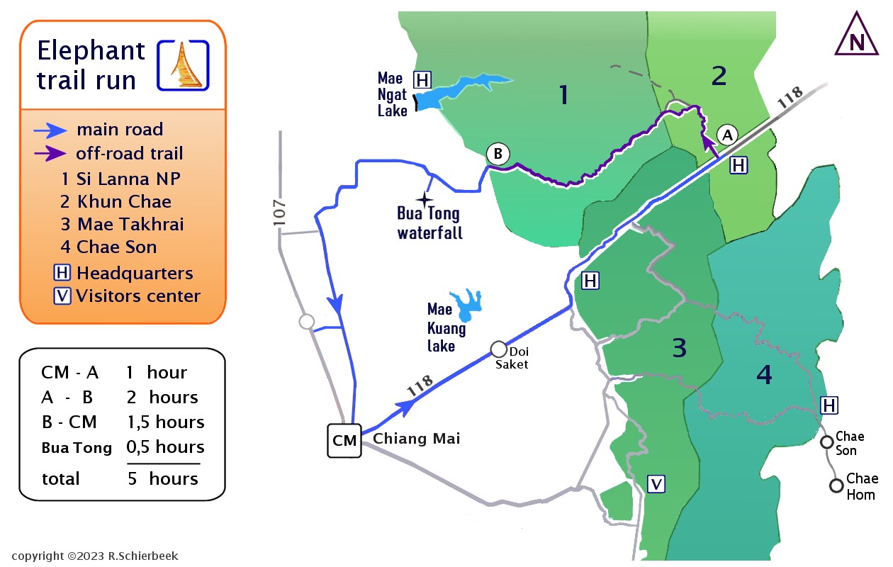
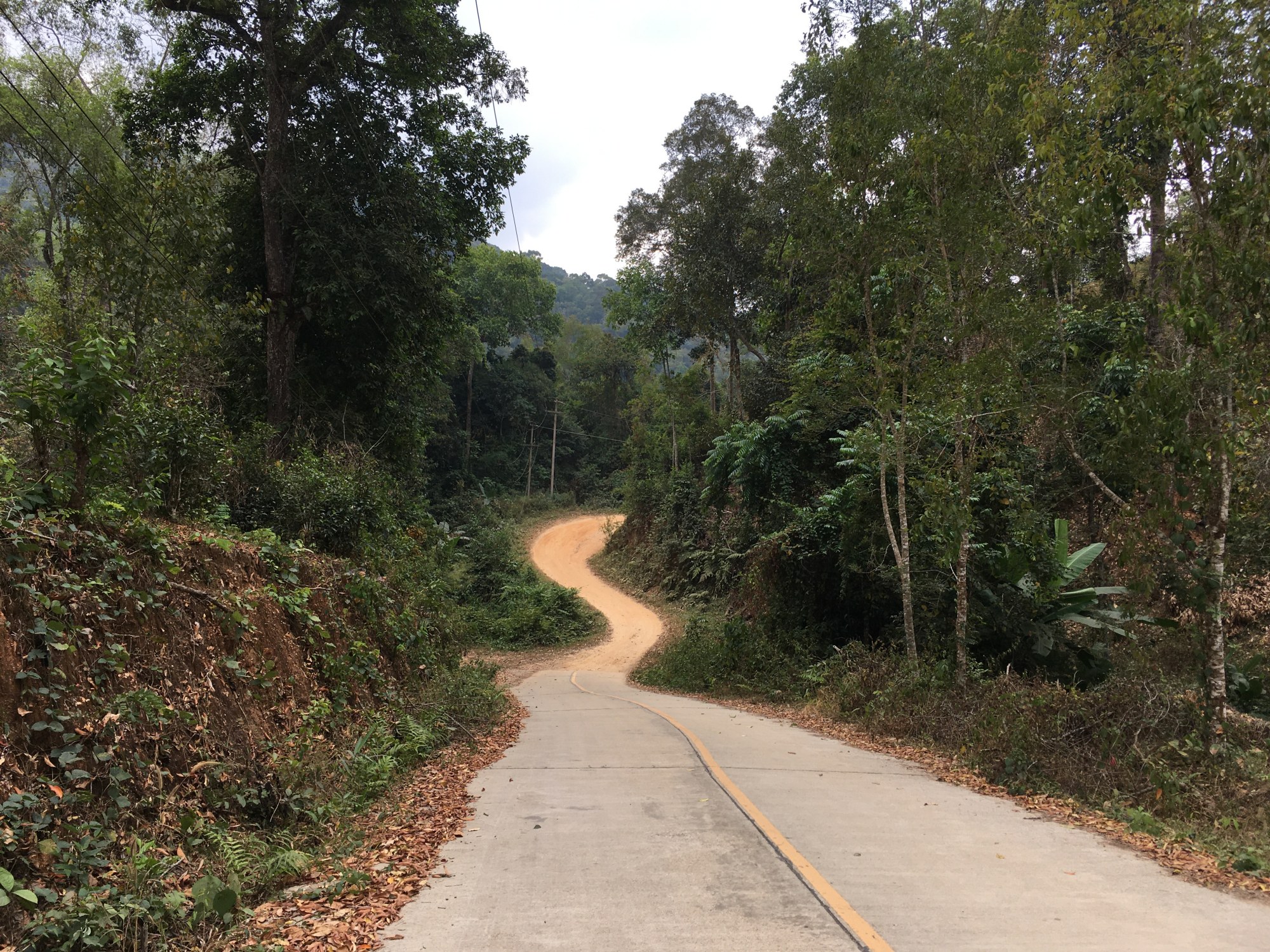
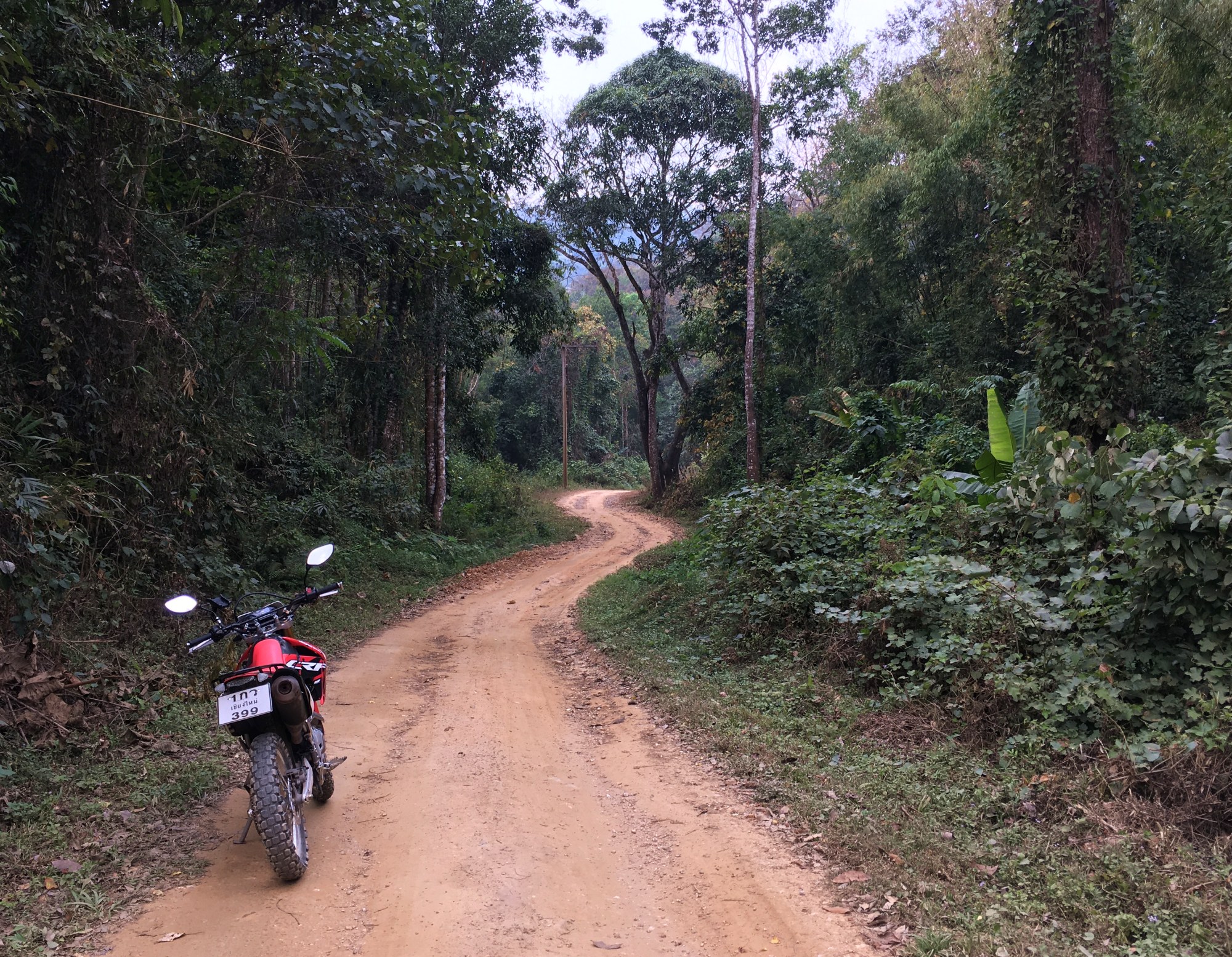
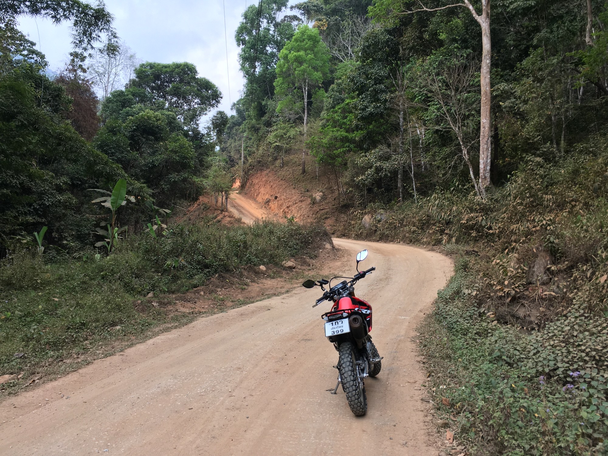
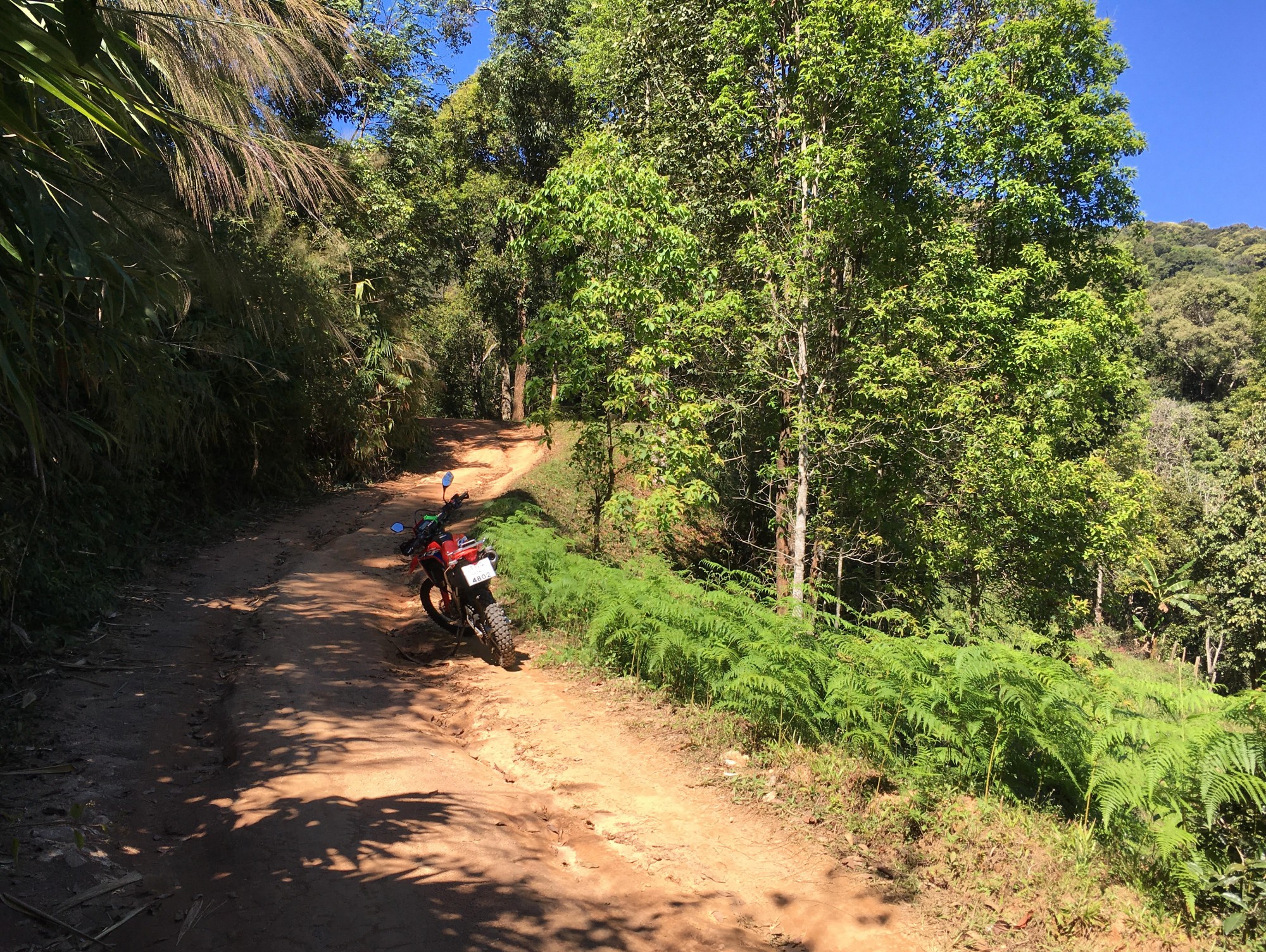
Turn off onto a small concrete road leading through the heart of Khun Chae National Park. At first there are small villages and houses, which soon disappear and only mountains and lush forest remain. Driving deeper into the park, the road becomes rougher and more challenging, the concrete turns into a dirt road requiring all your driving skills. The road makes steep inclines and descents, twisting through the majestic forest. This is an adventure that get more exhalating at every turn. As you wind your way through the forests and rugged terrain, you'll encounter mountain vistas, creeks winding through enchanting valleys, and butterflies galore.
What makes this off the beaten path trail so exhilarating on a motorbike? The quick turns, the steep dirt hills, the old rainforest growth? This is an old elephant trail, with inclines and turns that are only passable for elephants. Now, there are no more elephants lumbering across the mountain trails. Encountering a car or truck here is a rare occasion. There are just some small villages on the route, and the local villagers drive on motorbikes.
The elephants have disappeared, but the trail is very suitable for off-road bike trips: twists and turns, ups and downs across rugged terrain. At every corner the scenery changes, bamboo changes to old growth trees. There are bright green fern bushes next to tall dipterocarp trees with skyhigh canopies. Si Lanna is not as high as Chae Son Park, and therefore it's not possible to grow coffee here. Khun Chae National Park borders on Si Lanna National Park, where the scenery becomes even more inspiring. Here, you are driving along the Mae Khot creek, which you have to cross through a few times. Many of the water crossing places are filled with butterflies, and you can make a quick stop to take in the beauty of your surroundings. The Mae Khot creek eventually flows into the large Mae Ngat Reservoir up north.
As you emerge from Si Lanna Park, after a few hours of adventure and perhaps even exhilaration, (you didn't drop the bike and ate some dirt, right?) you can return to Chiang Mai on the main highway 107. An alternative is to head back onto route 1001 and continue following it all the way back to Chiang Mai. This route has less traffic than the 107 highway; the distance of both routes is the same. This journey is not for the faint of heart, but for those brave enough to venture off the beaten path, it's an experience of a lifetime. What are you waiting for? Hit the road, and get ready for The Elephant Run.
This is no "Easy Rider" loop!The Elephant Run, 165km. Duration: 5 hours, including a stop. The Elephant Run and the Samoeng Loop are two vastly different bike routes. The Samoeng Loop is considered an "Easy Rider" loop, doable on a scooter with relative ease. On the other hand, the Elephant Run is more "Into the Wild" and requires an off-road bike to navigate through the rough and sometimes challenging dirt roads of the national parks. The Elephant Run takes about 5 hours to complete, including a half an hour stop at Buatong waterfall. The offroad stretch cannot be done on a scooter; after all, you don't want to end up like the man who fell to earth.. Road condition: concrete and difficult dirt trails, a few passages through a shallow creek. The dirt road is in the process of being upgraded to a proper concrete road, so in a few years it will be much less challenging.
Khun Chae park nature trail - 3 kilometers, 2 hours.Khun Chae park visitor center is close to the start of the Elephant Run, and is worth a visit for a visit to the nature trail. Khun Chae nature trail is a well signed trail with the usual educational plaques and signs. It seems like a short walk of about 3 kilometers, but it is challenging for non-trekkers. I recommend to be very careful if you want to attempt the trail, and plan for 1,5 to 2 hours walk. The trail can be hard to see as it follows the stream and you have carefully use the big rocks as stepping stones in order to to cross the stream a few times. The trail is very steep uphill during the first half hour through some uninteresting low tree growth. Then is levels out, and one enters an enchanting bamboo forest. Large bamboo trees, butterflies, some fallen trees over the path. It then descends, and follows a stretch of track along the creek which is quite difficult. It needs crossing a few times by stepping on stones, and the path ahead is difficult to follow. This part is impossible with flip flop sandals, and one risks wet feet if missing a stepping rock.
|
|
A 1000 Miles on an Elephant - surveying ThailandWhy the Elephant Run?This trail is an old elephant trail, which was described and mapped by Holt Hallett in his book "A 1000 Miles on an Elephant". Holt Hallett's book is about surveying possible railroad routes and has detailed maps, and he explored northern Thailand in 1879, travelling by elephant.
Holt Samuel Hallett estimated his location with a compass and by observing the walking speed of his elephants; he went up north from Chiang Mai to Chiang Saen and back via another route. When the Royal Geographical Society's cartographer plotted his survey; he found that Hollett had calculated his location wrong by less than 2 kilometres. The cartographer was quite surprised about this "highly satisfactory result". Maybe this was a bit of luck, for example Viang Pow on the map is the old name of Phrao, on Hallett's map it is offset by a few kilometres.
At the time Holt Hallett was writing his book, published in 1890, another man was already surveying Thailand with more advanced equipment and methods. James McCarthy was using triangulation to survey Thailand; a much more accurate surveying method that measures the angles in a triangle formed by three survey control points. James McCarthy, who created Thailand’s first accurate maps, worked as Government Surveyor from 1881 to 1893 for the Royal Survey Department of Thailand. He published a book in 1900 about the survey of Thailand:
The dangers James McCarthy and his men endured resulted in the production of maps and surveys which were used for the planning for Thailand’s railway network. Unfortunately, McCarthy visited many towns in Shan state and Laos, but did not describe the town of Zimme/Chiang Mai in any detail. He seemed to have liked the small town of Luang Prabang (Laos) a lot, since he devoted a few chapters to it.
|
|
Background: aboutme Any comments or improvements? Please mail me at : bytelife AT gmail.com
“Do not go where the path may lead, go instead where there is no path and leave a trail."
All photos copyright © 2023 R.Schierbeek (except the historic black and white ones).
|